
MORGAN JAROCKI
Being a cartographer by preference means I get to dabble in a bit of everything;
graphic design, to data management, scripting, and more.
The real beauty is that I learn new forms of expressing a story and call it work.

The Pacific Northwest Recreation Map series covers entire National Forests and BLM land at a 1 inch to 2 mile scale and shows access to recreation across these lands. The Southern Washington Cascades explore the Gifford Pinchot National Forest, and the exciting opportunities scattered across the landscape shaped by the Cascade volcanic mountains.

The Pacific Northwest Recreation Map series covers entire National Forests and BLM land at a 1 inch to 2 mile scale and shows access to recreation across these lands. The Land of Umpqua is a peek into the rugged beauty of the Umpqua National Forest and surrounding lands, including Crater Lake National Park.
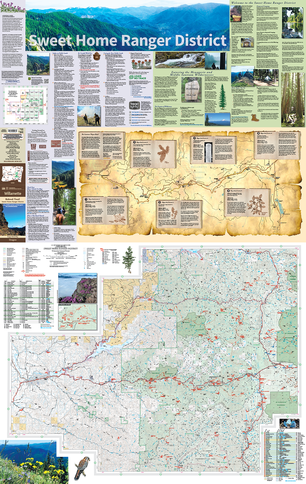
Ranger District maps are 1 inch to the mile maps printed and released to the public for informing where recreation sites are located and how to access them. The Sweet Home Ranger District was an opportunity to show the public how an old access point for settlers coming to the west coast via wagon trails has retained its wilderness across time.

Ranger District maps are 1 inch to the mile maps printed and released to the public for informing where recreation sites are located and how to access them. The Mount St Helens National Volcanic Monument and Ranger District offers a unique opportunity to interact with an environment heavily effected by the 1980 eruption.

Created for the U.S. Census Bureau Decennial Translation Branch to demonstrate the extent of the seven main non-English languages that surveys are translated to.

Three basemap styles created for Census web mapping applications. Left (Grayscale) and Center (Natural) are designed for thematic data overlays, while Left (Full Color) is a reference focused style.

The new integrated data hub for the U.S. Census Bureau includes a data mapping feature. Basemap and feature layers were custom designed in house. Located at data.census.gov

Created for the U.S. Census Bureau's Statistics in Schools program, which provides educators with tools to demonstrate the everyday use of statistics and the importance of the decennial census. Selected for ESRI Map Book Vol 33, 2018

A Population spread featured in the National Geographic 11th Edition Atlas of the World